
Tom Turner makes the case for involving landscape architects in cycleway planning and design

Written in the spirit of Sylvia Crowe’s Landscape of power and Landscape of roads, I have done 18 blog posts and videos on the need to plan and design a London Cycling Landscape (LCL). The aim is to support the case for involving landscape architects in cycleway planning and design. Cycleways are part of a city’s green infrastructure, and they require landscape assessment. If any LI members have been involved in the planning, design and/or assessment of cycle networks I would like to hear from them. It would be good to have a LI interest group to draft a policy paper. The videos were ‘inspired’ by 20 years of cycling in Edinburgh followed by 45 years of cycle commuting in South and East London. My first two-wheeler, at the age of 5, was cerulean blue and second hand.
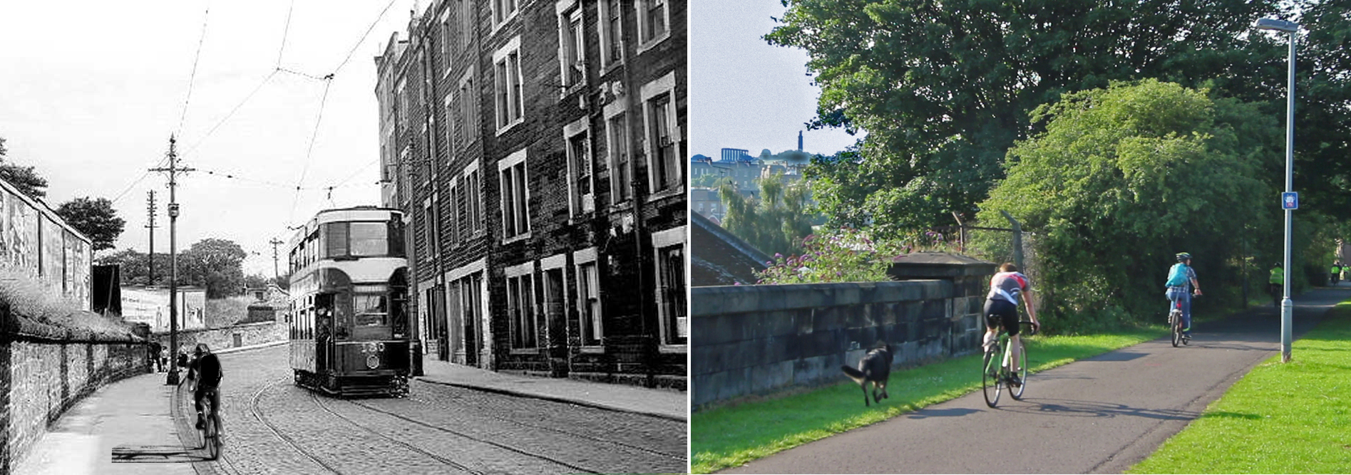
Edinburgh had cobbled streets, tricky tramlines, no provision whatsoever for cyclists and at least seven hills. When I moved to London in the 1970s, it had equivalent provision for cycling, but the streets were flatter, smoother and less windy. Edinburgh now has better cycle infrastructure than London, and has spent 10% of its transport budget on cycling. (A Scotsman came to a Stop Killing Cyclists demo outside the Treasury in Whitehall on 11 February 2017, begging for TfL’s budget to be raised from 1% to 10%. After saying ‘I bet you’re wondering what a Scotsman wears under his kilt’, he let us glimpse the answer: lycra.)
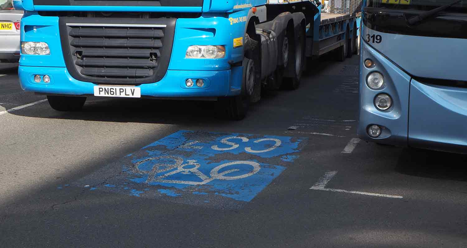
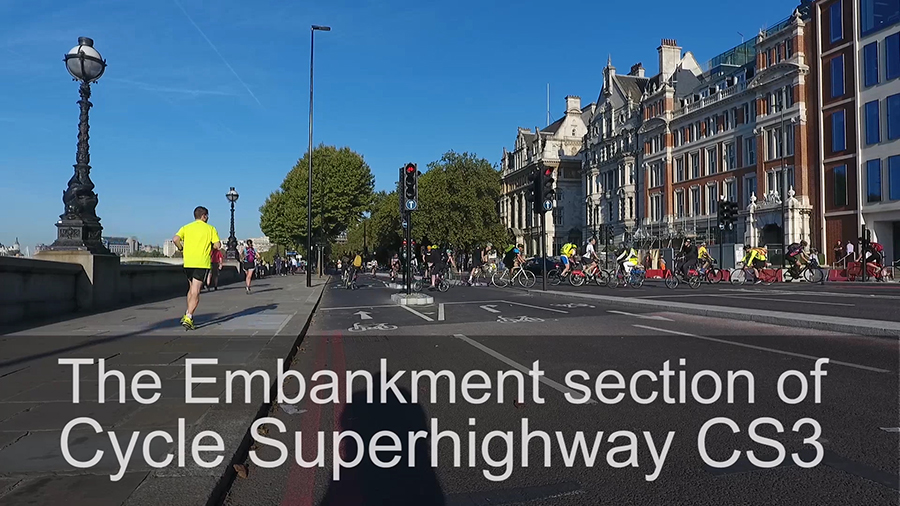
Ken Livingston enjoyed talking about London cycling but provided no useful facilities during his two terms as Mayor. Boris Johnson then disappointed London cyclists in his first term by spending money on Potemkin superhighways of little use. They were strips of slippy blue paint on roads. But in his second term, Johnson came up with the goods. He fought everyone who needed fighting to get London’s first ‘real’ cycle superhighways built. Best by far is the Embankment section of the East-West Cycle Superhighway CS3. I give it four stars instead of five because it suffers from traffic noise and air pollution. The best hope for a five-star Cycle Superhighway is on the west bank of the Isle of Dogs.
If you visit Central London without your own wheels, it is worth hiring a Santander Bike to ride between Westminster and Blackfriars. In the morning and evening rush hours there are great opportunities for the schadenfreude joy of bowling past indignant plutocrats in stationary limos.
Mayor Sadiq Khan says he will outspend his predecessor on London cycling infrastructure. Can the landscape profession help London catch up with Edinburgh, Amsterdam, Copenhagen, Freiburg, Moscow, Beijing and New York in the provision of cycleways? Yes. But instead of merely engineering a ‘cycle network’, we should help plan and design a London Cycling Landscape.
Packets of data flow round computer networks because they have to. Cycling is a voluntary activity. Users must be enticed – by fine streets, charming greenways, fresh air, birdsong, trees, flowers and butterflies. Drinking fountains and free public loos would be an added inducement. Just as architecture is more than construction, cycle planning is more than engineering. It can be landscape architecture at its best. TfL published a cycle route assessment method in 2015. Called the Cycling Level of Service (CLoS) method, it uses arbitrary weightings and is over-engineered. Five of the TfL assessment criteria are drawn from the Dutch CROW manual: Safety, Directness, Coherence, Comfort and Attractiveness. TfL added a sixth criterion: Adaptability (re transitions between modes and adaptability to usage). Cycling bloggers welcomed the method. I find it too complicated for cyclists and evidence for it being used only in Newham. Since we all understand Amazon’s star rating system I suggest a Simplified Cycle Route Assessment Method (SCRAM) for users of cycling infrastructure.
‘Attractiveness’ is a better criterion than one might think. First, it is accepted by CROW, CLoS and other assessment methods. Second, it pinpoints an essential characteristic of good cycle infrastructure: it must attract users.The Embankment section of the East-West Cycle Superhighway CS3 is attractive because of its directness and because it was built in a pre-existing high-quality urban landscape.
Another problem with cycleway planning in London is the confusion of commuter use with leisure use. The Embankment section of CS3 serves both objectives; the Upper Thames Street section has negative scenic quality, though it leads to a leisure destination, the Tower of London.
I hope Zac Goldsmith failed to become mayor of London in 2016 because he offered so little to the owners of London’s 4.4 million bikes. Goldsmith said he would ‘invest’ in Quietways instead of Superhighways – because they are cheaper. Quietways are built on backstreets which are ‘quiet’ because they take users, slowly and indirectly, from nowhere to nowhere. They are a compromise between leisure and commuting design objectives. They fail to satisfy either goal. As G. K. Chesterton observed: ‘Compromise used to mean that half a loaf was better than no bread.’ Now it means that ‘half a loaf is better than a whole loaf’. Q1 was the first London Quietway to open, in 2016. Only a quarter of its length is segregated from motor vehicles. The route is useful for short journeys and useless for long journeys. We should tell mayors that using desire lines for routing paths is a key principle in landscape architecture.

Tom, CSGNT is finalising a campaign and series of case studies (developed for us by HERE+NOW) on Green Active Travel exploring how best we can achieve or use Green space/ Green Infrastructure to deliver quality Active Travel and vice versa. We need to move away from silo transport budgets. The case studies will launched at the CSGN Forum on 15 June see http://www.centralscotlandgreennetwork.org/news-and-events/events/1189-csgn-forum-2017-15-june-2017
There are still spaces if you’d like to revisit Edinburgh.
If you can’t attend and want info send me an email at sue.evans@csgnt.org.uk
Thank you Sue. Sorry I did not see your comment when it was published. I do not know if the system notifies bloggers about comments.
In June I cycled some of Edinburgh’s cycle routes and was most impressed. But they do not seem to have been planned as an integrated travel network and I thought cycling on Princes Street was worse than I remembered. The new tram tracks were as bad as the old tram tracks and the domination by large diesels was most unpleasant.
Interesting read Tom – thanks.
I agree with all points made. However I still think if we are to move on and elevate ourselves as a profession, we need to much more clever in planning, specifying and detailing linear infrastructures. We need to consider opportunities to ensure infrastructure like this (and we are talking mega kilometers) should offer more than the primary benefits of cycling alone. The opportunities to offer tertiary benefits in terms of green Infrastructure and ecosystem services are huge. Good cycling brings good business; good cycling routes can bring improved sustainable drainage, biodiversity, better water and air quality and so much more en-masse.
We are talking about integrating connective networks and piggybacking the opportunity to use these networks for other purposes apart form cycling alone. It is these benefits that need to form part of the fundamental thinking behind planning these new infrastructures and right from the beginning. Landscape architects need to form part of collaborative thinking early on, not only with cyclists and engineers but also those who can demonstrate the wider economic and non-monetary benefits these opportunities can offer. In piggybacking we can save money
CIRIA are presently scoping out a study RP1046 Delivering Green Infrastructure Along Linear Assets. If you or others have great case studies to share not only on cycling networks, but also other transport and energy infrastructures then do please share with us at enquiries@ciria.org
Dear Suzanne,
Thanks so much for your insightful comment. Indeed, all infrastructure, if properly planned, should deliver multiple benefits.
I would be happy to include a call for contributions to CIRIA’s GI study in our news update. If this is of interest, please feel free to send more details to webmaster@landscapeinstitute.org.
That would be fantastic. We need to draw a line under outline material no later than mid may to keep our programme on track. Thanks i will forward to you!
We are involved (Stephen Caffyn Landscape Design) and are leading or part of the consultant teams in developing the Cycling Infrastructure and Standards for Singapore as part of 3 separate projects currently here with three different Government Authorities. All include cycling infrastructure – eg facilities such as toilets, shelters, drinking fountains, wifi, charging, repair posts, bike racks & lockers etc.
1. Round Island Route – 150Km long recreational walking and cycling route that circumnavigates Singapore. We are currently working on the first 60km, starting with Corridor B – Coastal Adventure, for which work about to commence on site. This project generally aims for a 6m wide footpath and cycle track (separated but parallel), includes bridges, boardwalks, facilities, wayfinding educational and interpretive signage, extensive native planting, habitat creation, sculptural elements, and also forms an ecological corridor. We had previously carried out Masterplanning for the RIR Corridor A as a separate project.
2. Cycling Network – This is a series of intra-town cycling networks aiming to connect peoples homes to public transport hubs. The project encompasses 6no. towns with one town already completed and the rest in various stages of design or tender for a total of approximately 76km of cycle paths.
3. Bishan to City Feasibility Study – This study proposes and investigates the feasibility of different solutions to overcome the major obstacles (mostly major roads) currently blocking the existing Park Connector (cycle and footpath) route alongside the Kallang river from Bishan Town to the City area of Singapore. Detailed proposals and costings for crossings, overhead bridges, and underpasses, and on-grade crossings have been made and have been exhibited for public feedback. We hope to move on to the implementation stage for some of the crossing in the next few months. We also carried out Cycling Audits for the crossings to assess the best option and treatment and think it is a useful objective tool for clients to obtain funding.
All our cycling projects are off road separated tracks – they shouldn’t really consider anything else.
Feel free to visit our website at http://www.land-arch.net we have some info there or email for more info.